By Joe Chick
Join Joe Chick as he takes to the streets of Coventry with the ‘History of England’s Places’ App to find the city that was there before the bombs.
On my first two walks, I explored the towns of Kenilworth (Warws.) and Colchester (Essex). On this walk I look at Coventry. The city has been a leading city of the English Midlands across the ages, returning to the limelight as the 2021 City of Culture.
My walk uncovered many historic buildings that survived the air raids but could be easily missed due to being hidden down side-roads. The Victoria County History (VCH) has published a detailed history of the city in volume 8 of its Warwickshire series. This is available via British History Online. The VCH’s A History of English Places app is an interesting way to explore Coventry, locating you on a first edition Ordnance Survey map that predates the destruction – and rebuilding – of the 20th century.
Walkers might also be interested to view some older maps that have been produced of Coventry.
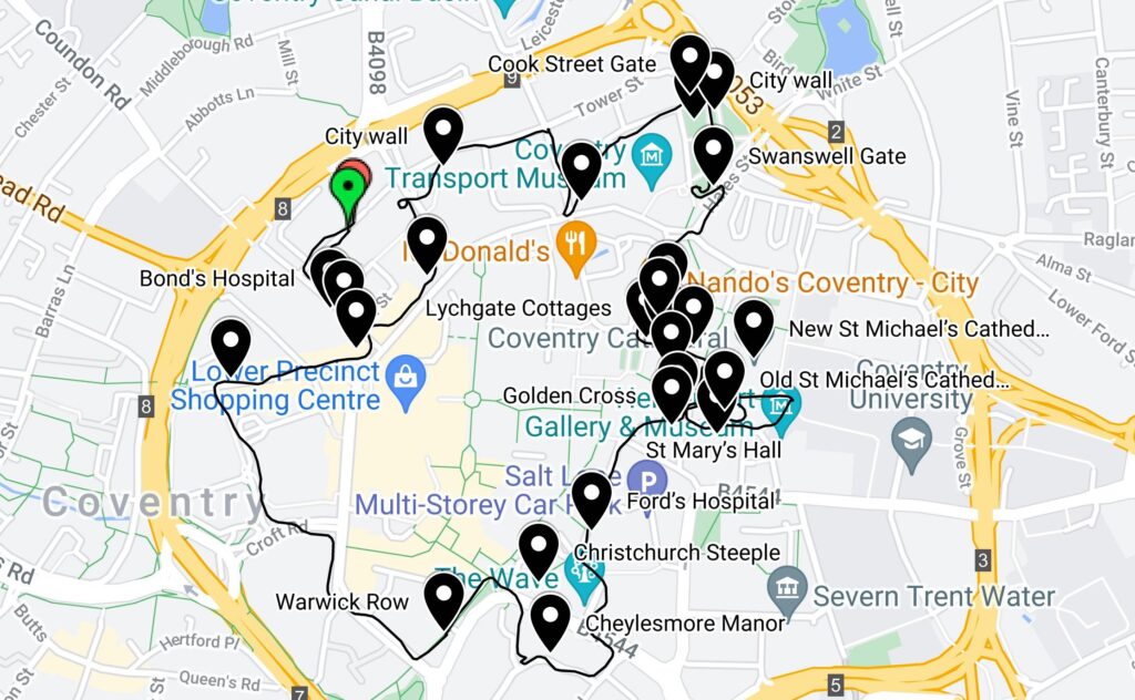
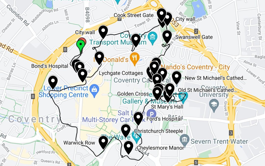
Joe’s walking route around Coventry
Medieval Coventry
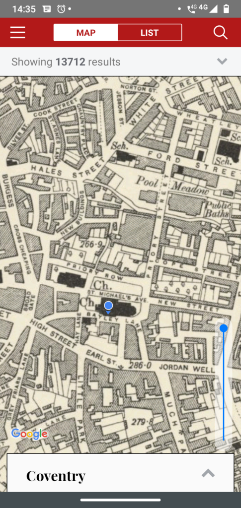
The Cathedral district of Coventry, as shown in the ‘History of England’s Places’ App.
The early medieval city was split into two. Half was governed by Coventry Priory and half by the earls of Chester, until the leading inhabitants gained self-government in 1355. Supported by the cloth industry, Coventry grew to rank as the third richest city in England but, from the late 15th century, it entered a period of economic and population decline. Some new businesses developed in the early industrial era, but it was the 20th-century motor industry that led to the city’s rebirth.
North of the Cathedral
Setting off from Belgrade Plaza car park, I soon reached Bond’s Hospital. Founded in 1506 by the draper Thomas Bond, it served as a residence for ten poor men and one woman. Alongside is Bablake School, formerly Bablake College, which began life in the 14th-century as the priest’s quarters for the nearby church of St John the Baptist. It was re-founded as a school in 1566 by the mayor Thomas Wheatley, allegedly following his accidental acquisition of a fortune after being sent barrels of silver from Spain in error.
Passing the Belgrade Theatre, built in 1956–8 in Coventry’s post-war recovery, a side street took me along one of the more intact remains of the city walls. An important status symbol, the building of these began after the city gained self-government in 1355. Next, I passed a chapel from the 1340s which had belonged to St. John’s Hospital. It was converted into a grammar school in 1558 and remained as such until 1885.
The Old Grammar School (St John’s Hospital) cc-by-sa/2.0 – © David Dixon – geograph.org.uk/p/3577238
Several sites are centred on Lady Herbert’s Gardens. I arrived through one of the two surviving medieval city gates, Cook Street Gate, and left though the other, Swanswell Gate. Further remains of the city wall run through the gardens, the site of Lady Herbert’s Homes. Founded in 1935–7, these almshouses offered 12 dwellings intended primarily to support the widows of those who had worked in Alfred Herbert’s machine tool business.
The Cathedral District
Before reaching the more obviously historic buildings, I passed a ribbon factory from the mid-19th century. The app’s non-subscription history of Coventry was published in 1848, before the motor industry. It describes ribbon making as the city’s leading industry. Subscribers to the app will be able to learn much more while walking Coventry’s streets with easy access to the VCH’s history of the city. Past the 15th-century Lychgate Cottages are the 13th- and 14th-century remains of Coventry Priory, the monastery which had been lord of half the city. Above, and incorporating some of the priory remains, is Blue Coat School, founded in 1856–7.
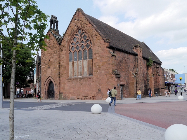
After passing through the cathedral precinct, I stood outside the Herbert Art Gallery & Museum to get a view of the new St Michael’s Cathedral. Built in 1951–62, this was the centrepiece of the city’s re-emergence from the destruction of the Second World War. Next, I passed St. Mary’s Hall, built in 1340–42 for city’s St Mary’s Guild but taken over by the more politically powerful Trinity Guild. In later times, it served as a meeting place for the civic government and entertainments. From here, I entered the remains of the old St Michael’s Cathedral, heavily damaged in an air raid in 1940. Only becoming a cathedral in 1918, for most of its history it was the largest of the city’s three parish churches. Close by is the third, Holy Trinity Church, whose surviving fabric dates from the 13th to 15th centuries.
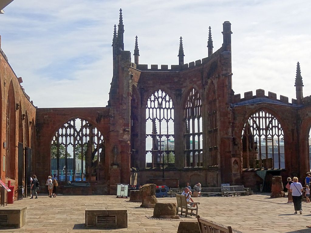
The ruins of the ‘Old’ Coventry Cathedral, formerly St Michael’s Church
Beyond the cathedrals, I passed the County Hall. This was built in 1783–4 on the site of the ‘old guildhall of the city’ and next to a gaol. Opposite is the Gold Cross, an inn believed to date from about 1583.
South and West of the Cathedral
In 1509, a certain William Ford provided for the foundation of an almshouse, known as Ford’s Hospital or Greyfriar’s Hospital, beside the gate of a Franciscan friary. Hidden in another side street is the gatehouse of the Cheylesmore manor. The present building is 14th century, but the manor had been the seat of the earls of Chester who governed half of the city in the early medieval period.
The next site I passed was the Christ Church steeple. This 14th-century tower was part of the Franciscan friary founded in 1234. After the Dissolution, most of the Friary was lost but the tower was held by the civic government until it became part of the newly founded Christ Church in 1832. Fire ensuing from an air raid in 1940 destroyed all but the steeple which, once again, was the sole remnant.
My walk passed through Warwick Row, home to a number of late 18th- and early 19th-century houses. Turning into Spon Street, you might easily think you’ve somehow strayed into Stratford-upon-Avon. Rather than an isolated historic building, here is a whole street of houses dating from the 14th to 16th centuries that survived the air raids. Originally built as low-cost housing, this street is now one of the greatest gems of Coventry’s history.
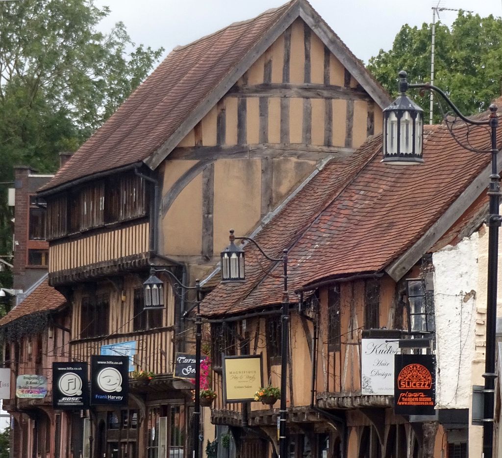
Late medieval houses on Spon Street, Coventry
Coming up, in the fourth blog in this series: Buxton in Derbyshire!
Dr Joe Chick studies English monastic towns and teaches medieval and early modern history at the University of Warwick. Joe currently holds a research internship with the IHR Centre for the History of People, Place and Community.