By Joe Chick
Take a walk around the historic sites of Kenilworth in Warwickshire with the aid of the Victoria County History’s ‘A History of English Places’ App.
Welcome to the first of several posts exploring the use of the Victoria County History‘s (VCH), ‘A History of English Places’ app. In July, the App was featured as part of the annual Festival of Archaeology as part of a collaboration with the Council for British Archaeology. The VCH’s editor, Adam Chapman, with phone in hand, took the app to Essex and to Walton-on-the-Naze. Over the next few weeks I will explore the app through a series of walks around historic sites across England.
‘A History of English Places’ is free to download and shows your position on a historic map of England, along with a local history of the area. Once downloaded, click the three lines in the top left to open the options menu. Switching on ‘show user location’ and pressing ‘show nearest 10 places’ allows the app to pinpoint where you are and shows the local parishes and towns.
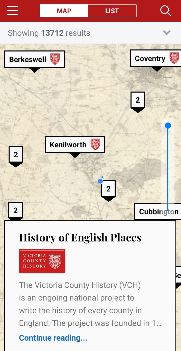
Screenshot from the ‘History of English Places’ App – the blue dot shows Joe’s location.
It will be immediately obvious that the map above is not a modern one. The app is organised around a joined-together version of the first edition Ordnance Survey maps from 1883–1913. The blue switch in the bottom right allows you to toggle between this view and a satellite image. Clicking on the nearest pin will open a short history of the area (if you are midway between areas, you might have to check a few pins to find the one you want). This is taken from Samuel Lewis’ Topographical Dictionary of England, a book published in the mid-nineteenth century that covers almost 14,000 English local areas.
In over 3,000 cases, a more detailed history, from the Victoria County History, is offered through the subscription version of the app. The Victoria County History project has been running for over a century with the aim of providing a history of every parish in England. The extensive information on topography and architecture makes the entries ideal for exploring the history of your local area. Less ideal is the size of the volumes, somewhat larger than a Lonely Planet guide. ‘A History of English Places’ is a more practical way to read the information on the go.
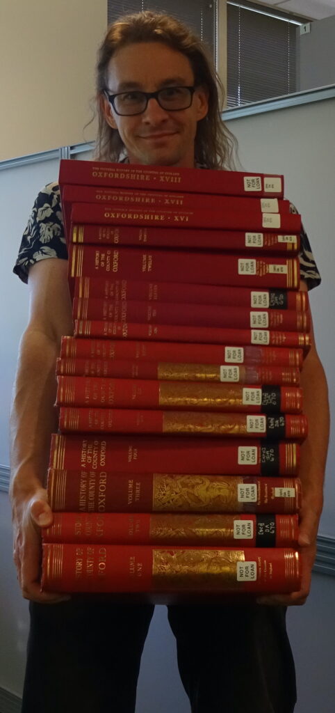
Our courageous blogger, carrying the complete – and very heavy – run of VCH Oxfordshire.
I begin by exploring my hometown of Kenilworth and you can follow the map of my route. The town owes its emergence to Geoffrey de Clinton, the chamberlain and treasurer of William the Conqueror’s son Henry I. Clinton founded its two most notable historic buildings, the castle and abbey, around which the town developed. From the app’s historic map, it is evident that much of the town’s growth came in the twentieth century. In fact, the majority took place since the Victoria County History entry was published in 1951. It states Kenilworth’s population as 10,000, less than half of where it stood in the 2011 census.
Kenilworth Abbey
My walk began at the Abbey Fields car park. Keeping the church to my right, I headed into Abbey Fields. A number of ruins of Kenilworth Abbey are visible and I reached the building known now as the abbey barn but described in the app’s entry as the guest house. North of this is a building with a clearer function: the abbey gatehouse which would have restricted entry to the large precinct that enclosed the monastic buildings. The app’s map describes the remains not as an abbey but as St Mary’s Priory. Founded in 1122 by Geoffrey de Clinton alongside his castle, the priory of Augustinian canons only gained the more prestigious title of abbey in about 1450, before being surrendered to Henry VIII in 1538 as part of his dissolution of the monasteries. The surviving buildings date from the fourteenth century.
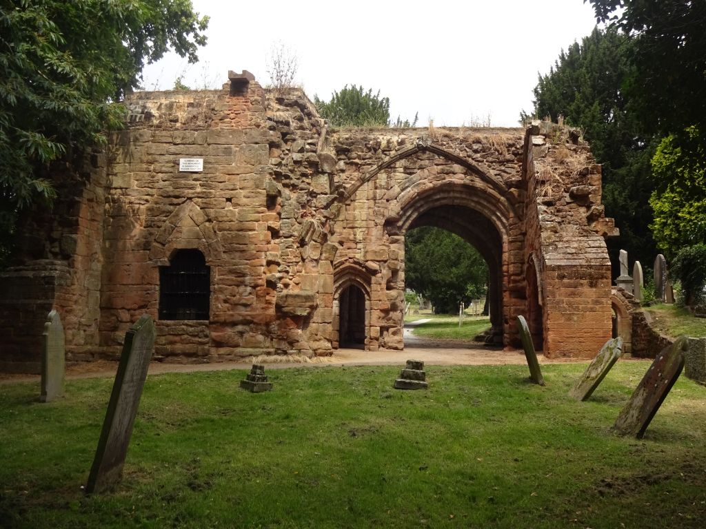
The ruins of gatehouse of Kenilworth Abbey
Continuing north, I soon reached St Nicholas’, one of two parish churches in Kenilworth. The main tower also dates from the fourteenth century, with a Norman entrance. Built of the same red sandstone as the abbey, the sixteenth-century parishioners may have used abbey remains for their own church, a practice common after the Dissolution. Turning left along the High Street took me past a range of old houses, most notably the sixteenth- and seventeenth-century cottages on Castle Green.
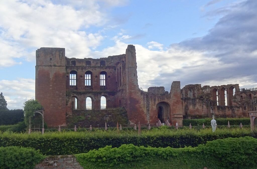
Kenilworth Castle
At this point, walkers can either continue around the edge of Abbey Fields straight to the castle or take the longer route on the map to the Pleasance. This area housed a lodge set up by Henry V in the early fifteenth century as a retreat from the castle. Following the route through the fields (ignoring the part where I went back on myself thinking I had missed the turning), you will return towards the entrance to Kenilworth Castle. The oldest part of Clinton’s twelfth-century foundation is the keep. However, the many additions by later notable owners are a testament to the castle’s continued importance. It was held in the later fourteenth century by John of Gaunt, the Duke of Lancaster (d. 1399) who effectively ran England for a number of years during the last years of his father Edward III and the minority of his young nephew Richard II. Much of the castle, including the Great Hall, date from Gaunt’s time. The late sixteenth century saw Elizabeth I visit the castle, then held by Robert Dudley, the Earl of Leicester. Hoping to wed the queen, he added Leicester’s Gatehouse and, less glamorously but equally importantly, a stable block large enough for the horses of a royal entourage.
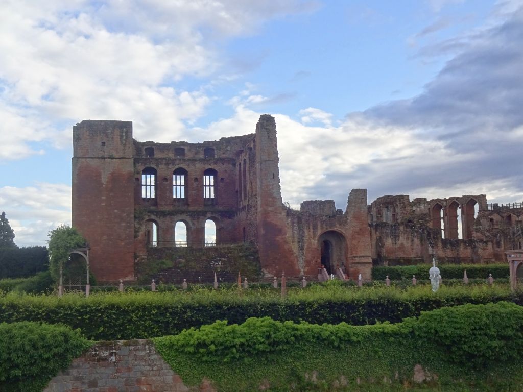
John of Gaunt’s Great Hall at Kenilworth Castle
Eighteenth- and Nineteenth-Century Kenilworth
On the final stages of my walk, I passed some of Kenilworth’s less well-known historic buildings, dating from the eighteenth and nineteenth centuries. Marked on the app’s map as ‘Edward’s Charity’ is the ivy-covered Old School House. The full history on the app reveals this to have been one of eight schools in Kenilworth founded by charitable donations in the era before comprehensive education, dating in this case from 1724.
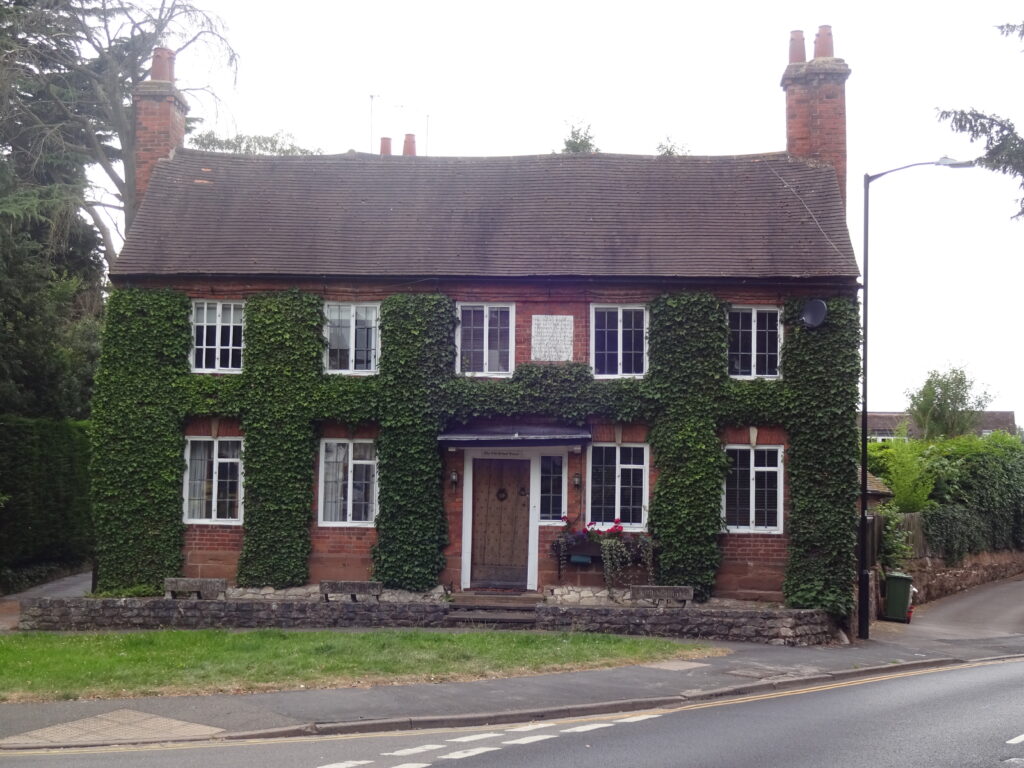
The Old School House, Kenilworth
Walking along the edge of Abbey Fields, I passed Dudley House, dating from the mid-eighteenth century, and reached the Priory Theatre. Not the most obviously historic building in Kenilworth, this began life in 1845 as a Unitarian Chapel, one of a number of nonconformist meeting places in the town. Turning briefly onto School Lane, another of Kenilworth’s schools was to my left. With a stone plaque labelled The National School, this was founded in 1836. Returning along the route around the edge of Abbey Fields, you can take a detour to the right to pass underneath the eighteenth-century stone bridge. The final steps of my walk took me past Fieldgate House, another residence from the mid-eighteenth century.
For my next blog, the app takes me further back in time, with a tour of Roman Colchester in Essex!
Dr Joe Chick studies English monastic towns and teaches medieval and early modern history at the University of Warwick. Joe currently holds a research internship with the IHR Centre for the History of People, Place and Community.
Get 'A History of English Places'
The app allows you to see this history and the layered archaeology of the landscape in front of you with fresh eyes and the convenience of the modern world. Why not try it today? Download it here.