By Adam Chapman
Do you want to explore England’s Past? Are you interested in maps? Then the Victoria County History’s App for mobile devices, ‘A History of English Places’ brings both these things together.
Developed by the IHR’s Victoria County History (VCH) project in collaboration with technical partner Aimer Media, it is a new way to access the British History Online web resource of nearly 1,300 volumes of British and Irish history and histories of empire, 40,000 images and 10,000 tiles of historic maps of the British Isles. And by opening the content of more than 175 of VCH’s ‘Red Books’, an ongoing public-sourced project to write the history of every county in England, and linking them to geographical places, it is bringing history to new audiences, tourism and conservation possibilities. ‘“Exploring Places”, the theme for the 2021 Festival of Archaeology, the annual flagship event of Council for British Archaeology (CBA), which in 2021 takes place from 17 July–1 August, offers a perfect opportunity to broaden the reach of the innovative VCH app and showcase the value of having detailed histories of over 3,000 English places at your fingertips” says Matthew Bristow, VCH architectural editor.
The purpose of the App is to break down the bounds imposed on VCH coverage by the format of book publishing – in some places three neighbouring parishes might lie in two different counties and three different volumes, divisions perpetuated by British History Online. No more! The ‘History of English Places’ app delivers an entirely new and dynamic way to access the topographical histories mounted on the British History Online (BHO) web resource. In the first instance, the free App offers the place-based descriptions in Lewis’ Topographical Dictionary of England (1848) and for a modest subscription, the town, parish, village and township histories published by the Victoria County History between 1901 and the present day; though it is hoped that further topographical descriptions will be added through a series of subsequent data releases. And there’s more. As part of the Festival of Archaeology, VCH will give a free licence to the full online content behind the app to the CBAs Young Archaeologists Clubs and local groups for use during their meetings, fieldwork and digs. Finally, the VCH will offer a 50 percent discount on first year subscriptions during the two-week life of the festival.
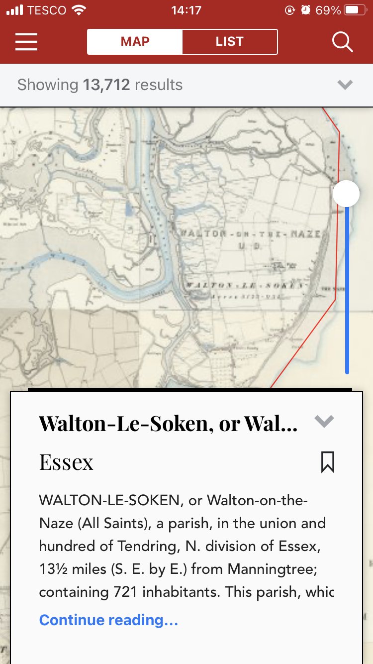
So how does it work? On 19 July, Adam Chapman, the VCH’s Principal Editor and Chris Thornton, editor of VCH Essex too Neil Redfern, executive director of the Council for British Archaeology (CBA) to the seaside. The aim was to explore one of the parishes that will feature in the next ‘Red Book’ from VCH Essex which explores the hinterland of the seaside resorts of Clacton-on-Sea, Frinton and – their target – Walton-on-the-Naze. With Chris’s expert knowledge and the benefit of the App, we were able to make sense of the history and landscape of the Naze peninsula as it has developed over the centuries. Walton, formerly called Walton-le-Soken, with its neighbours, Kirby-le-Soken and Thorpe-le-Soken once formed part of an enormous estate held by the Dean and Chapter of St Pauls cathedral. First recorded in the 10th century, the area of ‘The Soken’ remained almost independent of elements of county government into the 20th century, maintaining its own coroner until 1928. The medieval settlement has long been lost to the sea, its last building, the original church of All Saints, collapsing in 1796.
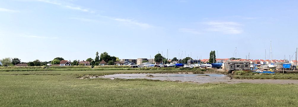
The town as we see it today is the work of the railway engineer, Peter Schuyler Bruff (d.1900) who was also responsible for the early development of Clacton-on-Sea. Though attempts had been made to establish a bathing resort in the 1820s and 1830s, rather in the manner of Sanditon in Jane Austen’s unfinished novel, Bruff brought the railway and developed a crescent and a range of hotels along the Parade. The app gives a snapshot of this history: the forthcoming Big Red Book will provide far more. When actually on the ground, ‘A History of English Places’, confirms that Walton is defined by water. Besides the tall brick tower built by Trinity House to guard the entry to Harwich there is a vast mill pond served a tide mill, one of several on this coast. Walton Channel, behind the town served saltings, landing places and quays (and, though the maps don’t show this, a rich tradition of smuggling) and bears witness to generations of conflict. One Napoleonic Martello Tower survives and another forms the basis of a round garden on the promenade. Pill boxes from both world wars can be found. One, from the First World War in the corner of a school playground. Others, built in 1940 on the cliff top, now line the foreshore, testament to the fragile coast.
Get 'A History of English Places'
The app allows you to see this history and the layered archaeology of the landscape in front of you with fresh eyes and the convenience of the modern world. Why not try it today? Download it here.
Dr Adam Chapman is Lecturer in Medieval History and Editor of Victoria County History, part of the Centre for the History of People, Place and Community at the Institute of Historical Research. You can follow him on Twitter.
Below is a screenshot taken from the VCH app, ‘A History of English Places’ which allows you to see where you are today more than 100 years go wherever you are.