This is the last in Joe Chick’s series of historic town walks using the Victoria County History’s app for mobile devices. ‘A History of English Places’ brings the VCH’s histories together with first edition Ordnance Survey mapping across England. Learn more here.
With so many historic sites, it is impossible to do Oxford justice in a short blog post. Indeed the VCH’s Oxfordshire series took more than two volumes to describe the university, with its colleges, and the town. Volumes 2, 3 and 4 are available on British History Online and can be accessed seamlessly through the subscription element of the app.
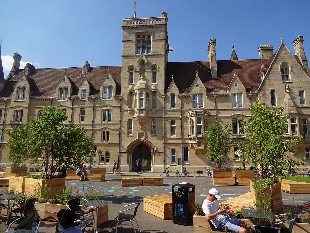
There can be an assumption among visitors that every old building they see is something to do with the university. The first-edition Ordnance Survey map reinforces that idea by emboldening every college.
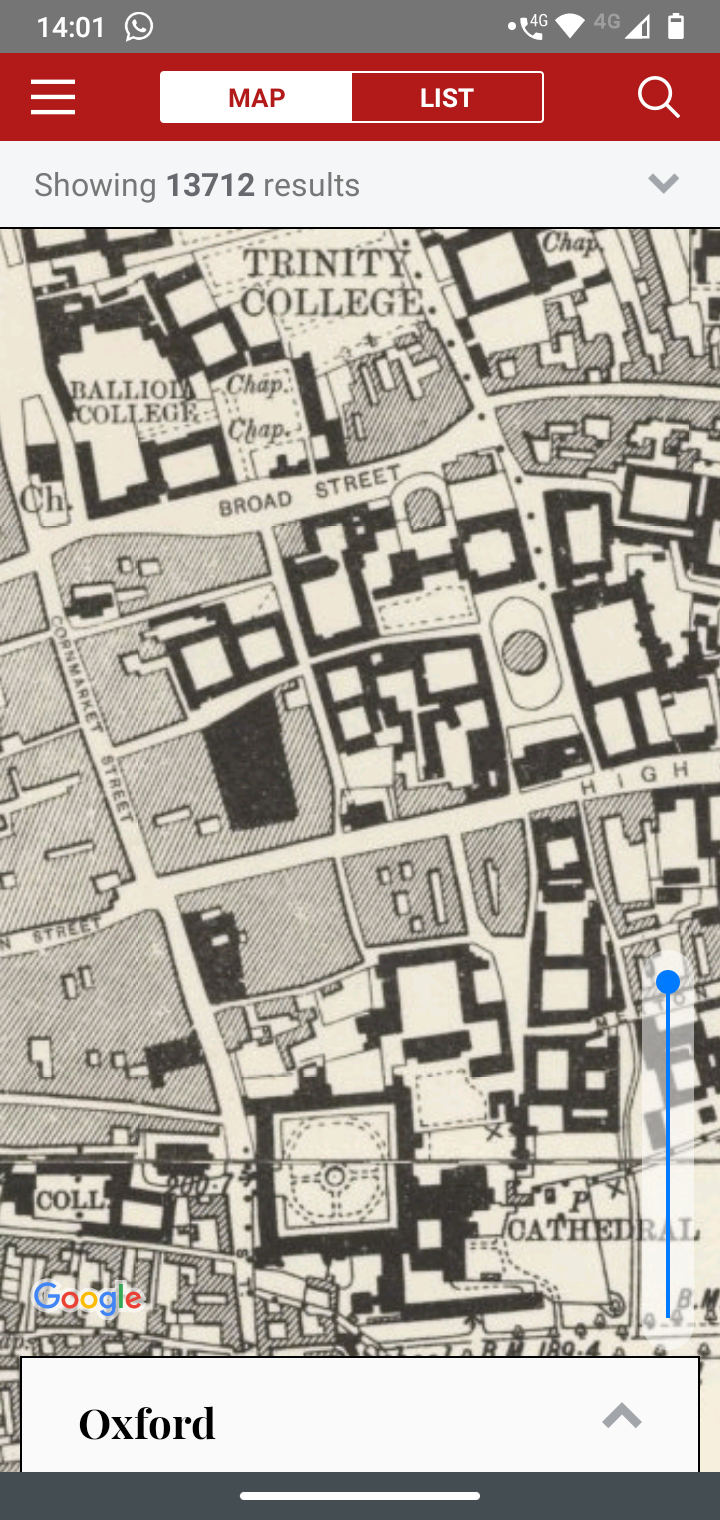
Screenshot from the ‘History of England’s Places’ app showing an early OS map of the centre of Oxford.
Yet there has long been a strong town identity distinct from the university. Today, it takes the form of town and gown competitions but has not always been so good natured. There were numerous killings in the medieval era, most notably the 1355 St Scholastica Day Riot, triggered by two students’ complaints over the quality of the wine they had been served.
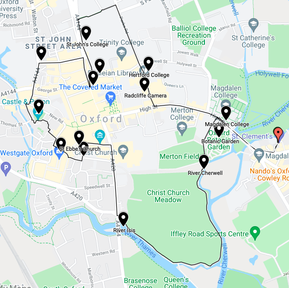
Joe’s walking route around the centre of Oxford. You can view it in more detail here.
Using the A History of English Places app, the walk passes some notable colleges in the early stages, then progresses beyond the university. This is the final post in this series of walking tours, but I would encourage you to go out and design your own!
The University
With its prominent tower, Magdalen College was my first sight on crossing the bridge into central Oxford. The Hospital of St John the Baptist once stood here, in existence by 1180 and suppressed in 1258 for the college’s foundation. The college statutes require the entertainment of English monarchs and guests have included Edward IV, Richard III, Henry VII’s eldest son Arthur, and James I. Less in keeping with its commitment, Oliver Cromwell and Thomas Fairfax stayed here during the Civil War.
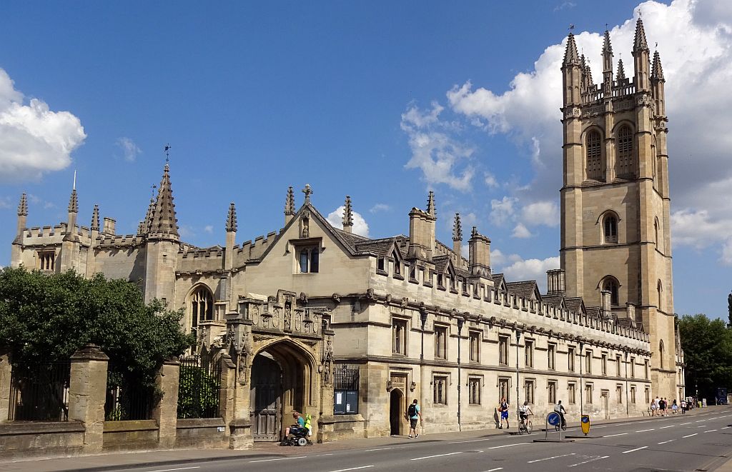
Magdalen College, Oxford.
Opposite, on the site of a 13th-century Jewish burial ground, lie the Botanic Gardens. Dating from the early 17th century, they are the oldest such gardens in Britain. They were managed by superintendents, the first of which published a 1648 catalogue of the garden’s 1,300 trees and plants.
The Radcliffe Camera is one of Oxford’s most distinctive sites. Built in 1737-49, it gained it present role as a Bodleian Library reading room for undergraduates in 1928. Passing Hertford College, with its ‘Bridge of Sighs’ over New College Lane, I reached Balliol College.
Balliol is one of three colleges that claim the oldest foundation, the others being University College and Merton. All three originate from the period 1249-64, with the order unclear. Although in the south of England, it was founded by John Balliol the father of the king of Scotland. The street outside Balliol is known to have been the site of at least one public execution, in 1680.
Balliol College, Oxford.
With the largest endowment of any Oxford College, facing stiff competition, is St John’s College. It began life in 1437 as St Bernard’s College for Cistercians before being converted into St John’s College in 1555. It has had a major impact on town society. In the 18th century it owned the Gloucester Green workhouse and, as lord of Walton manor, took the tolls from the St Giles’ fair that was initiated late in the century.
The Town
The oldest building in the town centre, however, is not part of the university. The west tower of St Michael’s church predates the Norman Conquest, being built in 1040. The parish church once stood by the North Gate into the town.
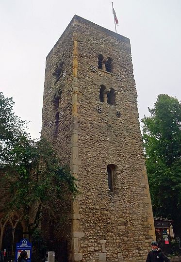
The tower of St Michael’s Church, Oxford
Along Beaumont Street lies a plaque marking the site on which Beaumont Palace once stood. The palace, which lay just outside the town walls, was built in the early 12th century by Henry I and known in its early years as the king’s houses. In 1157, Richard I was born here. In 1318, Edward II granted the palace to the Whitefriars or Carmelites which had been founded their friary in the town in 1256.
Before the building of the palace, English kings visiting the town stayed at Oxford Castle. This motte and bailey castle was built in 1071 on the site of an earlier settlement. In a bid to secure William the Conqueror’s control over the country, the High Sheriff of Oxfordshire Robert d’Oilly built the castle as a stronghold for maintaining order. It contains St George’s Tower which may be even older, suggested by some as 1020. Until 1996, the castle was part of Oxford Prison but is now maintained as a visitor attraction.
The new Westgate shopping centre may not be a historic site itself, but its upper floor offers an impressive view over Oxford. It also has on display the floor of the Franciscan Friary which once stood here, uncovered during the building of the shopping centre. Oxford was once home to many religious houses and this friary was founded in 1224.
Nearby is a surviving section of the town’s southern wall. Oxford’s walls were first built in c.900, but this section dates from the 13th century. Passing these, I reached St Ebbe’s Church. The present church dates from the 12th century, but an earlier Saxon one stood here. Its dedication is uncommon, perhaps referring to the Northumbrian St Æbbe of Coldingham or possibly being a separate, otherwise unknown, saint.
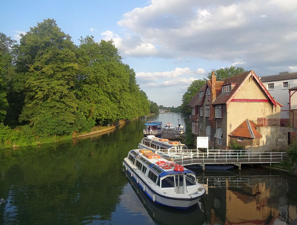
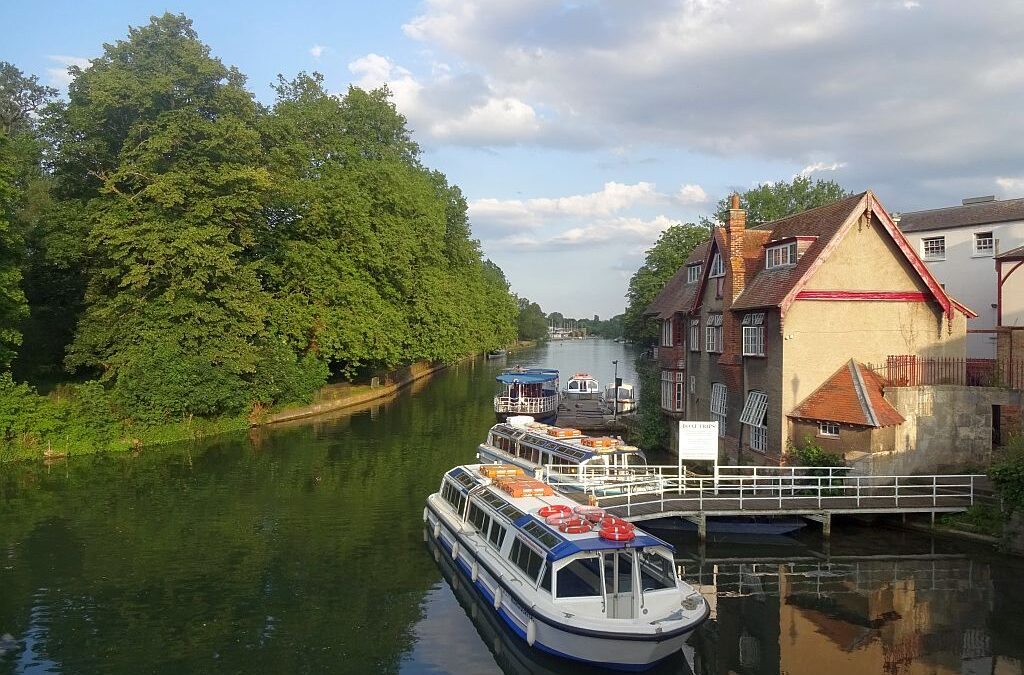
The river Isis or Thames from the Abingdon Road bridge
On the final stage, I walked through Christchurch Meadow along the rivers Isis and Cherwell, passing the point at which they join. The Isis, the local name for the Thames, linked Oxford to London. It was one of four royal rivers, being managed by an official appointed by the king known as water bailiff. The Cherwell once separated Oxford from the settlements lying to the east. With the rise of the motor industry, areas such as Cowley, home of Morris Motors and latterly the reincarnation of the Mini, became an integral part of the city.
The VCH Oxfordshire project continues. Just three volumes are left to complete the county. The Trust would appreciate your support.
Get A History of English Places
The app allows you to see this history and the layered archaeology of the landscape in front of you with fresh eyes and the convenience of the modern world. Why not try it today? Download it here.
Dr Joe Chick studies English monastic towns and teaches medieval and early modern history at the University of Warwick. Joe currently holds a research internship with the IHR Centre for the History of People, Place and Community.