By Simon Townley
The Victoria County History (VCH) is known for its meticulously researched parish and urban histories, the epitome of an approach which aims to build history from the ground up rather than imposing it from above. By studying groups of parishes within their wider geographical setting the VCH also contributes to regional history, identifying and exploring broad themes across extensive and sometimes internally contrasting areas.
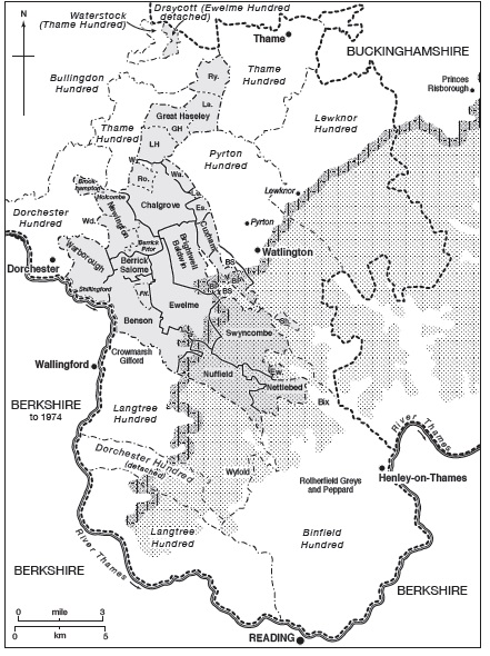
The parishes of Ewelme Hundred c.1840, straddling the vale and Chiltern hills © University of London
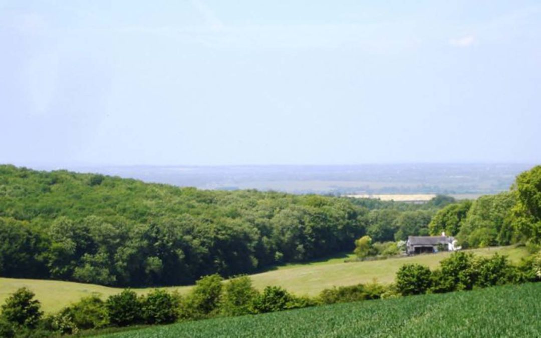
The most recently published Oxfordshire volume – which appeared in book form in 2016, and which has just gone live on British History Online – looks at the fourteen rural parishes and 30 separate settlements which made up Ewelme hundred in the south-east of the county. This is an area of some 25,000 acres which extended from Thames-side villages such as Warborough and Benson up onto the Chiltern hills around Nettlebed, not far from Henley-on-Thames. The complex relationship between vale and upland forms one of the volume’s unifying themes, along with the social and economic pull of London some 35–40 miles to the east, and the long-term influence of a large Anglo-Saxon royal estate focused on Benson, whose gradual fragmentation gave rise to the later pattern of manors and parishes.
Writing in 1916 the agriculturalist John Orr concluded that the Chilterns were ‘marked off’ from the rest of the county ‘with considerable definiteness’, and in the 16th century the term ‘Chiltern’ was still used to denote a distinctive upland zone characterised by dispersed settlement, early enclosure, and extensive wood-pasture – a landscape markedly different from that in the vale, with its nucleated villages and large open fields.
Yet despite the contrasts, symbiotic links between the two zones were long established and persisted into modern times. Tenth-century charters refer to ‘fielden wood ways’ (fildena wudu weg), suggesting Anglo-Saxon transhumance routes connecting upland wood-pastures with lowland settlements. Several such links were preserved in the structure of later medieval manors, which though based in the vale retained distant woodland outliers. The pattern was sometimes perpetuated in parish boundaries, lowland Ewelme and Newington, for instance, retaining small detached woodland areas near Nettlebed as late as 1932. That is not to say that the Chilterns’ own upland communities, some of which were well established by the late 11th century, did not also develop arable-based mixed agriculture, sometimes with marked success. Their activities took place, however, within a very different setting of small private closes, isolated farmsteads, and scattered hamlets clustered for the most part around greens and commons, all set amidst woodland which local landowners mostly kept in hand.
Such contrasts raise questions of identity and belonging, which a related Leverhulme-funded project led by Dr Stephen Mileson explored in more detail than the VCH could normally manage, and which will ultimately lead to an independent monograph. Migration between vale and upland during the pre-Black Death period seems to have been limited, although the fact that the main market and craft centres were in the lowlands must in itself have fostered some contact. Parishes such as Benson and Ewelme straddled the two zones, their eastern parts lying in the Chiltern foothills and containing scattered outlying farmsteads some distance from their main village centres. Medieval bynames derived from such places suggest a strong sense of local identity, and some outlying inhabitants certainly attended and supported churches which were physically closer, rather than their own more distant parish church. More subtly, medieval bynames and field names hint at perceptions of place and landscape amongst ordinary people, revealing further contrasts between the two zones.
With no towns or major market centres within the study area, another theme is the shifting pull of places outside, amongst them Oxford, Abingdon, Wallingford, and Reading, and above all London, the main gateway to which from the Middle Ages was through the important inland port of Henley-on-Thames a few miles from Nettlebed on the far side of the Chiltern hills. Much of the area’s medieval grain and wood production (particularly firewood) was geared to the London market, with produce carted overland to Henley and then transferred to barges. Imported goods made the journey in reverse. The 17th-century re-opening of the river for heavy barge traffic as far as Oxford undermined Henley’s primacy, but did not fundamentally alter the underlying pattern.

Ewelme church: the tomb of Alice de la Pole (née Chaucer), duchess of Suffolk© University of London
London’s relative proximity was also manifested in other ways. One of the glories of the area is the extraordinary 15th-century complex of church, school, and almshouse at Ewelme, which features some of the earliest (and finest) medieval brickwork in the county, and is the work of Geoffrey Chaucer’s granddaughter Alice and her husband William de la Pole, duke of Suffolk. The de la Poles, like Alice’s father Thomas Chaucer, were prominent figures deeply involved in national politics, typical of the sort of people forging power bases in the Thames valley within easy reach of the royal centres at Oxford, Woodstock, London, and Windsor. A slightly later example is the royal administrator Sir John Williams (d. 1559), who built an equally impressive Tudor mansion at Rycote of which only fragments remain. Both families left their mark on the landscape not only through their building projects but through the creation of parks, that attached to Ewelme extending up into the Chiltern hills.
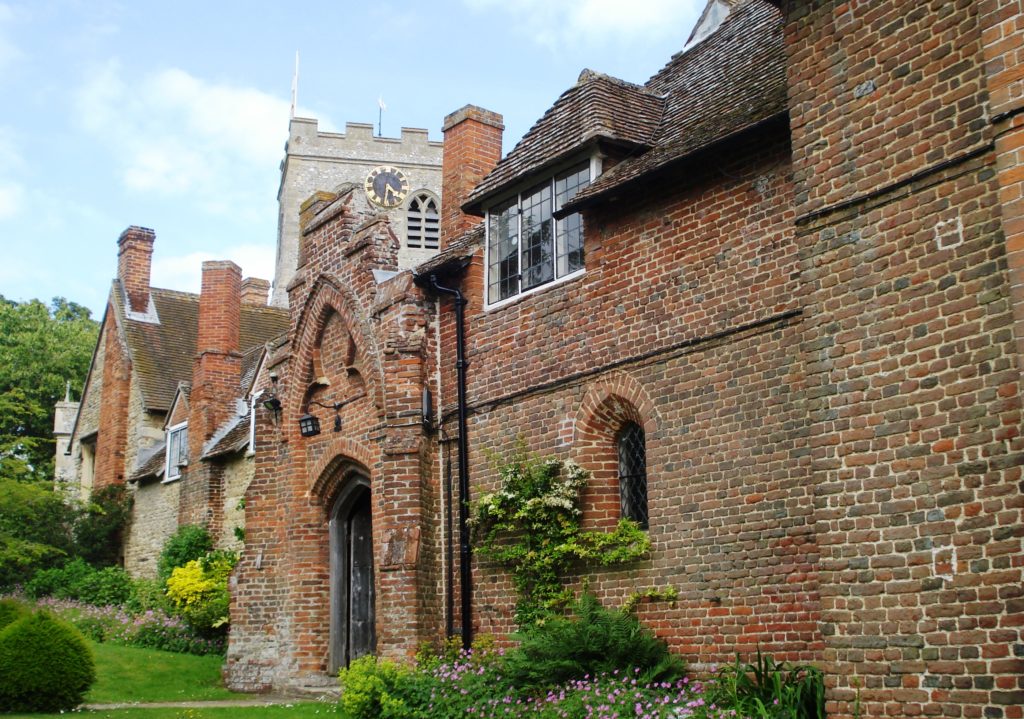
The entrance to the 15th-century Ewelme almshouses © University of London
The main London roads across the Chilterns were turnpiked in 1718–19 and 1736. The southernmost road ran through Nettlebed and Benson, which both developed as coaching stops: most of Benson’s smart brick frontages date from that period, although it remained a primarily agricultural village, and never remotely rivalled places such as Henley or Marlow. As elsewhere, arrival of the railway in the 19th century killed the coaching trade almost overnight, as it also did the long-established Thames river trade.
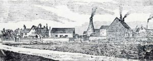
Pottery kilns at Nettlebed on the Chiltern uplands c.1900-10: woodcut from an unidentified source
The over-all range of themes is (as with all VCH volumes) considerably wider, touching on aspects of landscape, settlement, economy, society, and religion from prehistory to the present day. Coverage of buildings benefited from work with the Oxfordshire Buildings Record, and as well as manor houses examines the area’s smaller vernacular buildings, which combine timber framing (some of it in low-quality elm) with use of brick, flint, and chalk. Local trades included Nettlebed’s important pottery, tile, and brick industry (established by the 14th century), supplemented by piecemeal quarrying, brewing and malting, and (at Benson) small-scale coach building.The greatest modern landscape changes were the creation of wartime airfields at Benson and Chalgrove, the first of which is now one of the largest RAF stations in the county, while the Chalgrove site has been occupied since 1946 by the Martin-Baker Aircraft Company. Nuffield, on the Chiltern uplands, is now widely associated with the pioneering Oxford car manufacturer and philanthropist William Morris (Lord Nuffield), who moved there in 1933 and whose vernacular-style house (Nuffield Place) was opened by the National Trust in 2012.
VCH Oxfordshire XVIII (Benson, Ewelme, and the Chilterns: Ewelme Hundred) is available at British History Online along with all other published Oxfordshire volumes; or to buy from Boydell & Brewer. Oxfordshire XIX (Wychwood Forest and Environs) will be published during 2019. For more information visit the VCH Oxfordshire website or follow us on Twitter.
 Dr Simon Townley is County Editor of the Victoria County History of Oxfordshire for which he has made major contributions to seven Oxfordshire volumes and has edited five (with a sixth on the way).